
UAS (Unmanned Aircraft Systems), also known as drones, use photogrammetry to acquire high resolution images and accurate spatial data for surveying and mapping projects.
What is Photogrammetry?
Photogrammetry is the science of collecting physical information from 2D photos captured by high resolution cameras. These cameras are mounted to a drone, which takes many overlapping images of the same feature from many different viewpoints, allowing software to generate photo realistic 3D representations of ground surfaces in the form of a point cloud. These point clouds can be used to generate topography and utilized to create rectified images. These rectified images are compiled into an orthomosaic map (orthographic photos) that can be used to accurately scale distances across a parcel of land or locate improvements.
Our drone survey services can be used by engineers, designers, developers, planners, contractors, and construction managers to aid with design, analysis, planning, monitoring and constructing of all private and public projects.
Benefits
- Increased accuracy – each drone survey is referenced to survey grade ground control to ensure reliable results.
- Reduction of field time – large sites can require days – or weeks – to acquire field date. Drones substantially reduce field time on large open sites.
- Improved graphics – aerial images and videos assist design engineers and clients, especially for visual presentations.
- Improved safety – drone surveys eliminate the need for survey personnel to obtain survey data in unsafe areas, especially along highways and rails.
Whenever feasible, we incorporate drone technology into our boundary surveys, ALTA / NSPS Land Title Surveys and topographic survey work.
Unlike manned aircraft or satellite imagery, drones fly at a much lower altitude, making the generation of high-resolution, high-accuracy data, much faster, less expensive and independent of atmospheric conditions such as cloud cover.
Deliverables
- Orthomosaic Aerial Images (Geo – referenced and scalable)
- Aerial Isometric Imagery
- Digital Terrain Models (DTM’s)
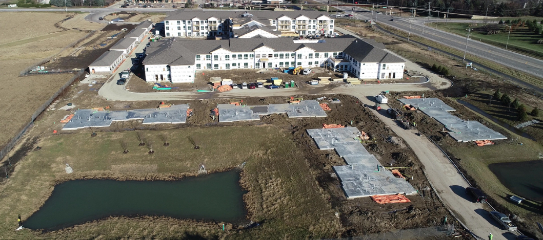
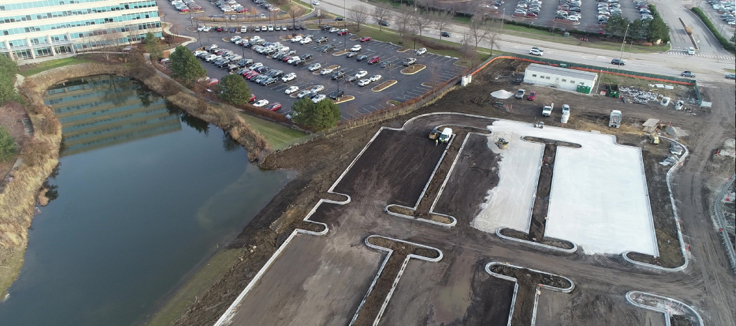
- Construction Progress Monitoring (for progress & payout)
- Mass Grading Verification
- Volume and Stockpile calculations
- 3D point Clouds
- Contour Lines
- Existing Conditions Surveys
- Video Inspections
To learn how this service can benefit your project, contact us at 630-820-9100 today to speak with a Compass Professional.